


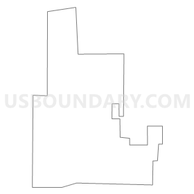
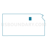
Clay Center Ward 2, Clay County, Kansas
About
Outline
Summary
| Unique Area Identifier | 584248 |
| Name | Clay Center Ward 2 |
| County | Clay County |
| State | Kansas |
| Area (square miles) | 0.69 |
| Land Area (square miles) | 0.69 |
| Water Area (square miles) | 0.00 |
| % of Land Area | 99.94 |
| % of Water Area | 0.06 |
| Latitude of the Internal Point | 39.38546770 |
| Longtitude of the Internal Point | -97.11643770 |
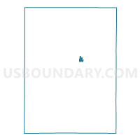
Maps

Graphs
Select a template below for downloading or customizing gragh for Clay Center Ward 2, Clay County, Kansas


Neighbors
Neighoring Voting District (by Name) Neighboring Voting District on the Map
- Clay Center Township Voting District, Clay County, KS
- Clay Center Ward 1, Clay County, KS
- Clay Center Ward 3, Clay County, KS
- Clay Center Ward 4, Clay County, KS
- Hayes Township Voting District, Clay County, KS
Top 10 Neighboring County Subdivision (by Population) Neighboring County Subdivision on the Map
- Clay Center city, Clay County, KS (4,334)
- Clay Center township, Clay County, KS (390)
- Hayes township, Clay County, KS (222)